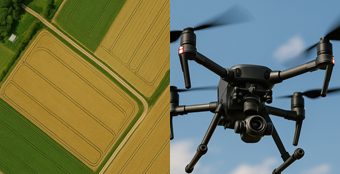
In the fast-paced industries of construction, agriculture, environmental management, and surveying, accurate mapping data is vital. Traditional mapping methods, while useful, often fall short in efficiency, scale, and precision. Enter orthomosaic mapping—an advanced aerial imaging technique powered by drone technology that delivers high-resolution, geometrically corrected maps. These maps provide measurable, real-world data that professionals can use to make informed decisions, streamline workflows, and enhance project outcomes. At the forefront of this transformation is 1st Choice Aerials, offering cutting-edge drone mapping services designed to bring unparalleled accuracy and efficiency to a wide range of industries.
What Is Orthomosaic Mapping?
Orthomosaic mapping is the process of creating a highly accurate, georeferenced map from multiple aerial photographs captured by drones. These images are stitched together using advanced photogrammetry software to produce a single, seamless map. Unlike standard aerial images, orthomosaics are geometrically corrected—or orthorectified—so that distances, angles, and positions are represented accurately, just like a true map. Every pixel in an orthomosaic corresponds to real-world coordinates, allowing precise measurement of distance, area, and elevation.
Using drones for orthomosaic mapping offers a distinct advantage over satellite or manned aerial imagery. Drones can fly at lower altitudes, capture higher-resolution images, and focus on specific areas with great detail. The end result is a detailed, data-rich visual representation that supports better planning, design, and decision-making.
How Drone-Based Orthomosaic Mapping Works
Creating an orthomosaic map involves several key steps, all designed to ensure precision and accuracy. First, drones equipped with high-resolution cameras are programmed to fly over a defined area along a carefully planned flight path. The drone captures hundreds or even thousands of overlapping images from multiple angles, ensuring complete coverage of the target zone. These images are then processed through specialized photogrammetry software that uses algorithms to align, stitch, and correct distortions caused by the drone’s movement or camera angle.
The software also incorporates GPS and ground control point (GCP) data to align the imagery with real-world coordinates. The final orthomosaic is a true-to-scale, top-down map that can be integrated into Geographic Information Systems (GIS) or Building Information Modeling (BIM) platforms for further analysis and application.
Key Technologies Behind Orthomosaic Mapping
Modern orthomosaic mapping relies on several technological innovations working in harmony:
High-Resolution Imaging: Drone cameras capture ultra-detailed images with resolutions that far exceed those from satellite imagery, allowing for pixel-level accuracy.
GPS and RTK Systems: Real-time kinematic (RTK) GPS enhances positional accuracy during data collection, minimizing errors and improving spatial alignment.
Photogrammetry Software: Advanced algorithms process images, correct distortions, and generate 3D surface models to create accurate orthomosaics.
LiDAR Integration: In challenging environments with dense vegetation or elevation changes, LiDAR sensors can complement photogrammetry to improve depth and elevation accuracy.
Applications of Orthomosaic Mapping Across Industries
Orthomosaic mapping has found a home in countless industries due to its precision, versatility, and scalability. From construction to agriculture, the insights provided by these detailed aerial maps are invaluable for planning and analysis.
Construction and Infrastructure Development
In the construction industry, orthomosaic mapping supports every stage of a project, from site evaluation to completion. Drones can map vast job sites in minutes, providing engineers and project managers with accurate topographic data and real-time progress updates. Orthomosaic maps help identify grading inconsistencies, track material movement, and verify that work aligns with design specifications. These high-resolution visuals enhance collaboration among stakeholders and help ensure projects are completed on time and within budget.
Land Surveying and Urban Planning
Surveyors and urban planners rely on orthomosaic mapping to capture up-to-date, accurate spatial data. The ability to create centimeter-accurate maps enables precise measurements for boundary identification, zoning, and land-use planning. For municipal projects, orthomosaic maps are invaluable in assessing infrastructure needs, visualizing developments, and maintaining accurate geospatial records.
Agriculture and Environmental Management
In agriculture, orthomosaic mapping provides farmers with actionable insights for precision farming. By analyzing aerial maps, they can monitor crop health, optimize irrigation, and identify pest or nutrient deficiencies. Environmental professionals use orthomosaics to assess natural habitats, track erosion, and manage land conservation efforts. The ability to capture repeatable, time-stamped data allows for monitoring environmental changes over time with unmatched clarity.
Mining and Resource Management
Mining operations benefit immensely from drone mapping by enabling detailed volumetric analysis and excavation tracking. Orthomosaic maps assist in calculating stockpile volumes, assessing pit progress, and ensuring regulatory compliance. The efficiency and safety improvements offered by drones are particularly valuable in rugged or remote mining locations where traditional surveying poses significant challenges.
The Advantages of Orthomosaic Mapping with Drones
Drone-based orthomosaic mapping offers a host of benefits that make it superior to conventional ground-based surveying and satellite imaging.
Unmatched Accuracy and Resolution
Drone orthomosaics deliver centimeter-level precision, ensuring that measurements and models reflect real-world dimensions. This level of detail is critical for design, construction, and compliance applications where even minor inaccuracies can have costly consequences.
Speed and Efficiency
Drones can survey large or complex sites in a fraction of the time it takes using traditional methods. The ability to rapidly capture and process aerial data enables faster turnaround times for deliverables, keeping projects on schedule and reducing costs.
Cost-Effective Data Collection
By eliminating the need for expensive manned aircraft and reducing on-site labor, drone orthomosaic mapping provides a cost-efficient alternative. The high-quality data produced by drones eliminates the need for multiple site visits and rework, further lowering operational expenses.
Enhanced Safety
Drones can access hard-to-reach or hazardous areas safely, such as steep terrain, active construction sites, or industrial zones. This removes the need for surveyors to physically enter risky environments, enhancing workplace safety while maintaining data accuracy.
Integrating Orthomosaic Data into Workflow
One of the key advantages of orthomosaic mapping lies in its compatibility with various software platforms and systems. The georeferenced maps can be integrated into CAD, GIS, and BIM systems for detailed design and analysis. Project managers can overlay orthomosaics onto existing blueprints or terrain models to verify progress and detect deviations. The ability to visualize data in both 2D and 3D provides a comprehensive perspective, empowering teams to make confident, data-driven decisions.
Why Choose 1st Choice Aerials for Orthomosaic Mapping Services?
When precision, quality, and reliability matter, experience makes all the difference. Check out 1st Choice Aerials, a leader in drone-based mapping and aerial data solutions, offers professional orthomosaic mapping services tailored to your project’s needs. Using the latest in UAV technology and processing software, 1st Choice Aerials delivers high-resolution, accurate, and ready-to-use data that drives smarter planning and execution.
From initial site surveys to detailed post-processing, their team ensures every step is executed with precision and efficiency. Whether you need orthomosaic mapping for construction, environmental management, or infrastructure development, 1st Choice Aerials combines technical expertise with state-of-the-art tools to deliver results that exceed expectations.
The Future of Orthomosaic Mapping
As drone and imaging technologies continue to advance, orthomosaic mapping is becoming even more sophisticated. The integration of artificial intelligence (AI) and machine learning allows for automated feature recognition, change detection, and predictive analysis. Real-time mapping capabilities and cloud-based data sharing are making collaboration easier and more immediate than ever. With these innovations, orthomosaic mapping will continue to play a pivotal role in digital transformation across industries.
Moreover, the environmental benefits of drone mapping are significant. By reducing the need for heavy equipment and minimizing on-site disruptions, drones promote more sustainable surveying practices while lowering carbon footprints.
Mapping a Smarter Future
Orthomosaic mapping is not just a tool—it’s a revolution in spatial intelligence. With the precision and efficiency of drone technology, industries can visualize and manage their projects with unprecedented clarity. Whether for construction, agriculture, or environmental preservation, the ability to transform aerial images into measurable, actionable data is shaping the future of how we understand and interact with our surroundings.


